
The 24km-long Rail Corridor stretches from Woodlands to Tanjong Pagar. It was formerly a railway line used for commuting and transporting goods between Singapore and the rest of the Malay Peninsula. The land used to belonged to Malaysia but was returned to Singapore in 2011 providing an opportunity for the authorities to turn it into a space for the community.
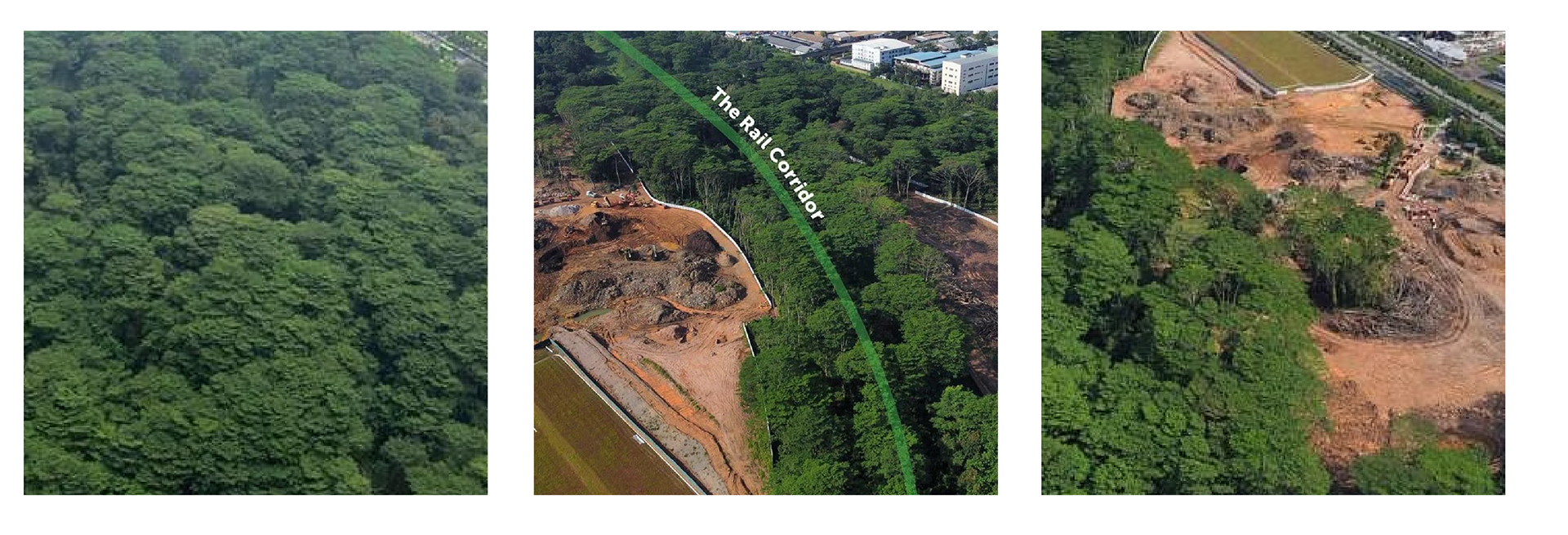
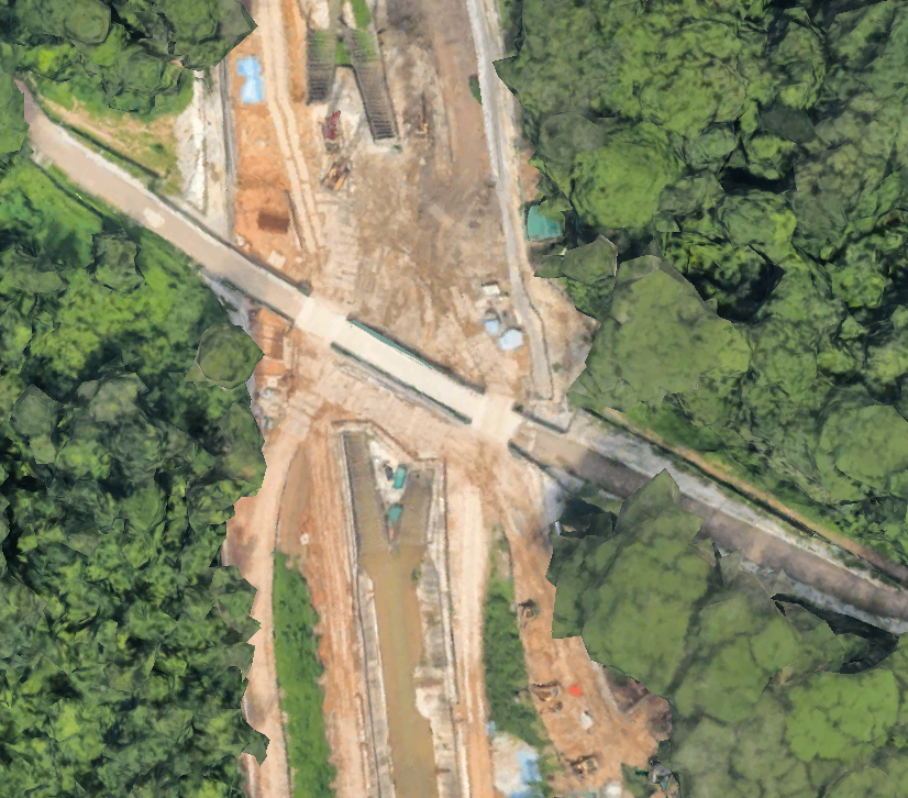
In 2020, an unauthorized clearing of woodland by a developer in Singapore sparked outrage on social media. Aerial images comparing the lush greenery in 2019 to the barren land in February 2021 shocked the public and environmentalists. This deforestation led to the loss of species and exacerbated global biodiversity decline. The incident underscored concerns about transparency and governance in land management, particularly in the Kranji area.
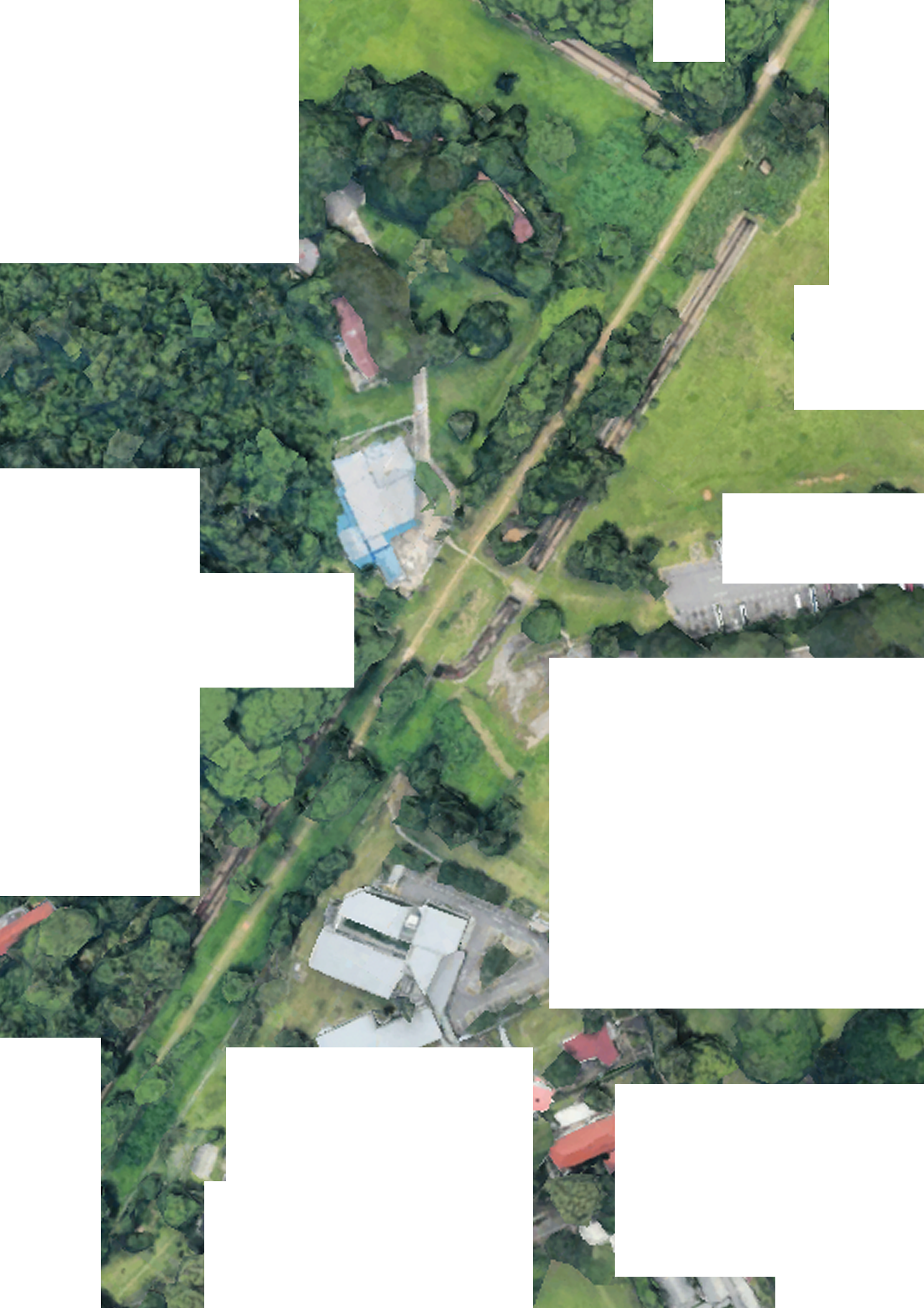
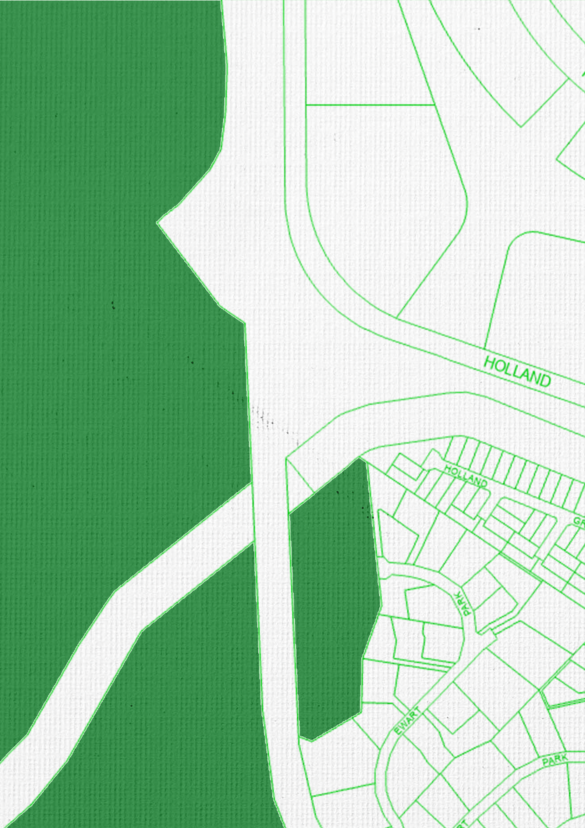
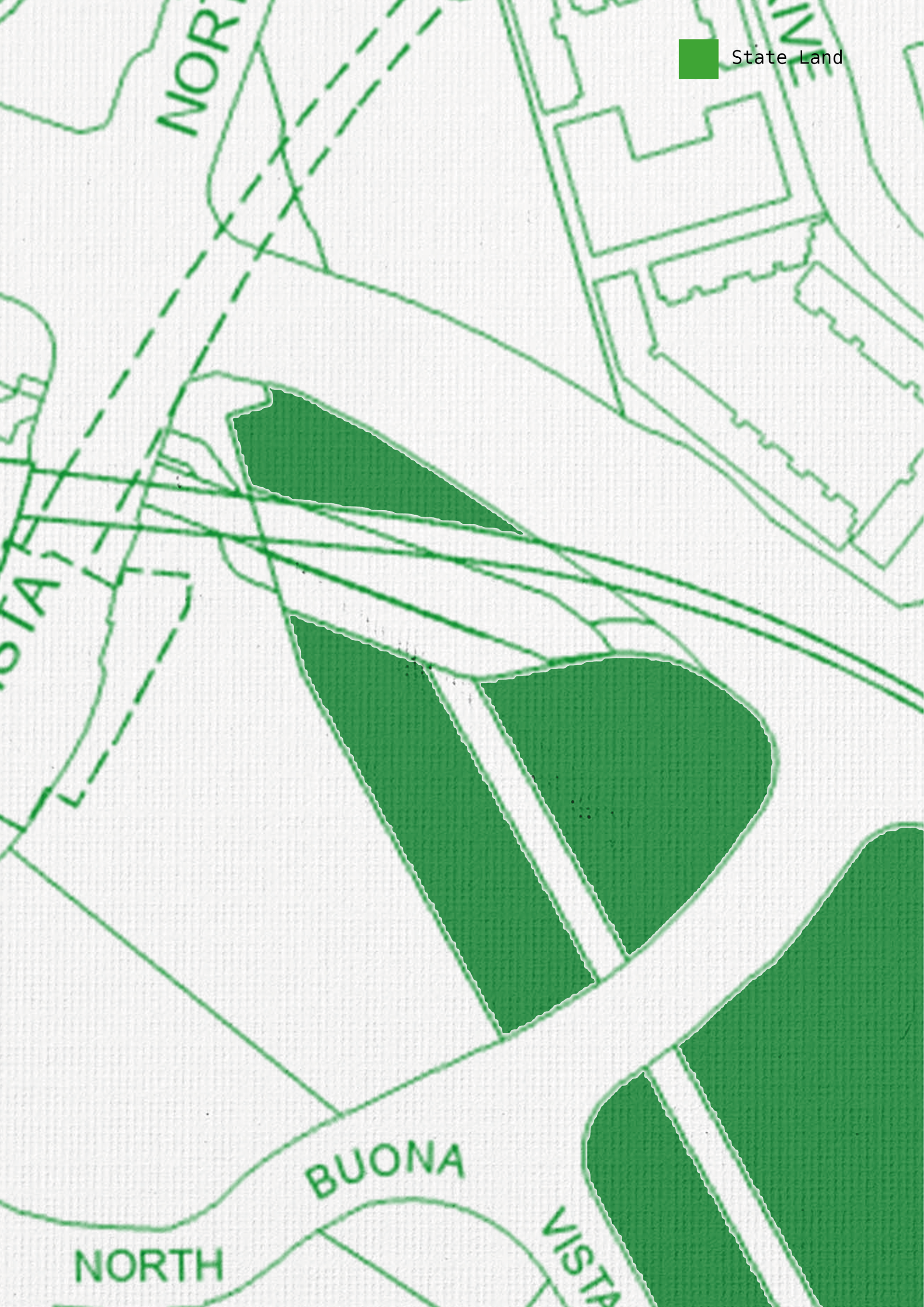
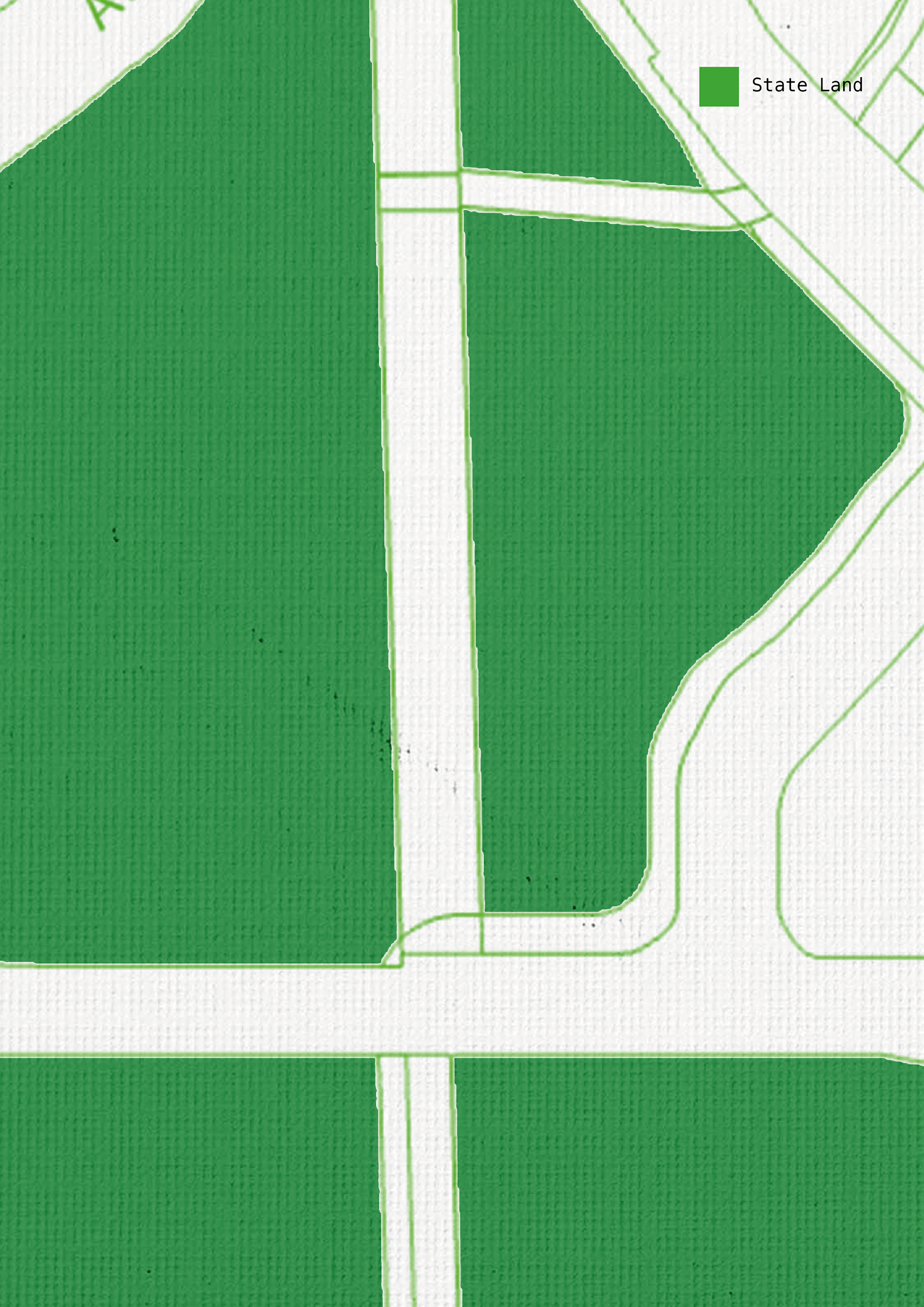
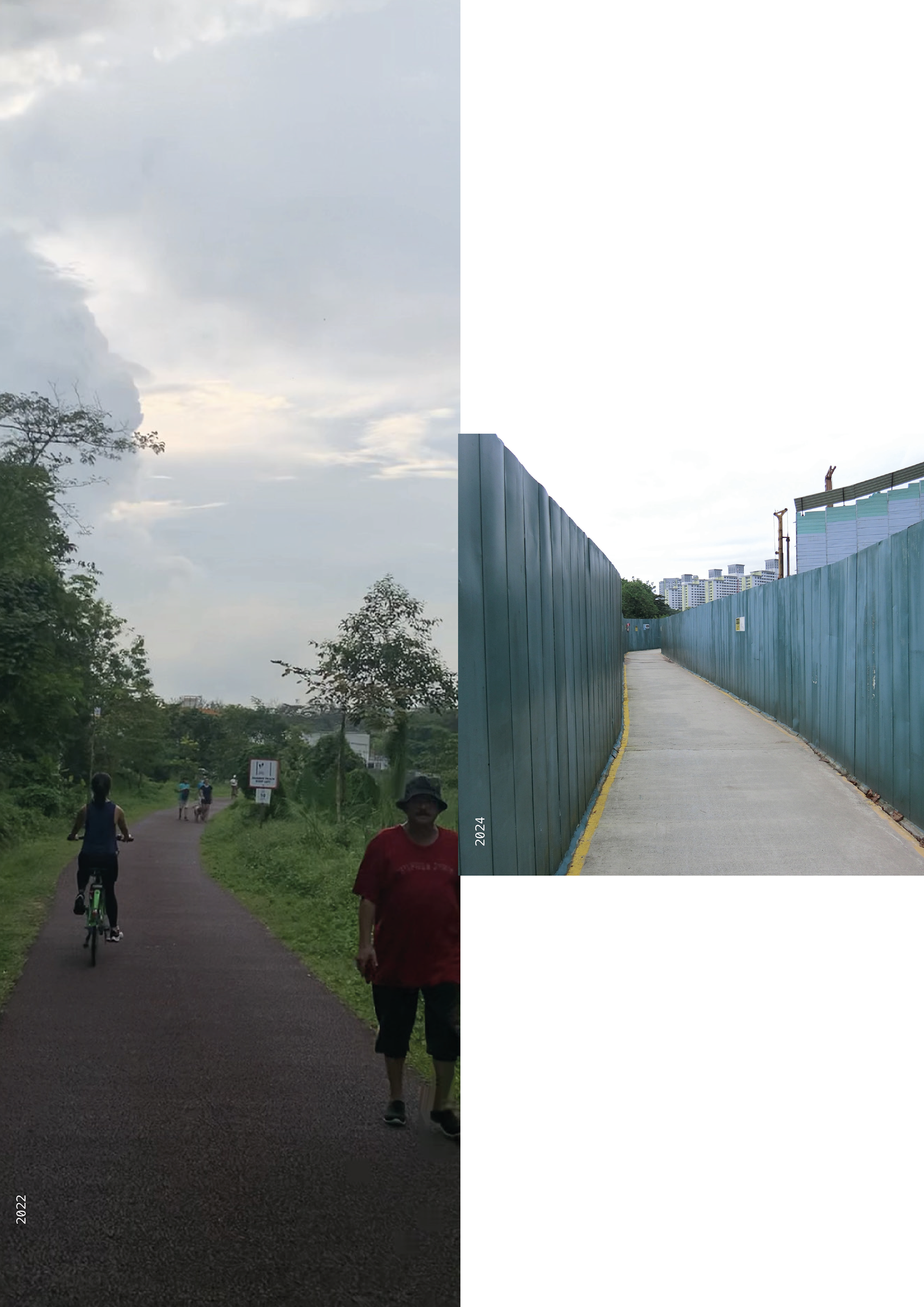
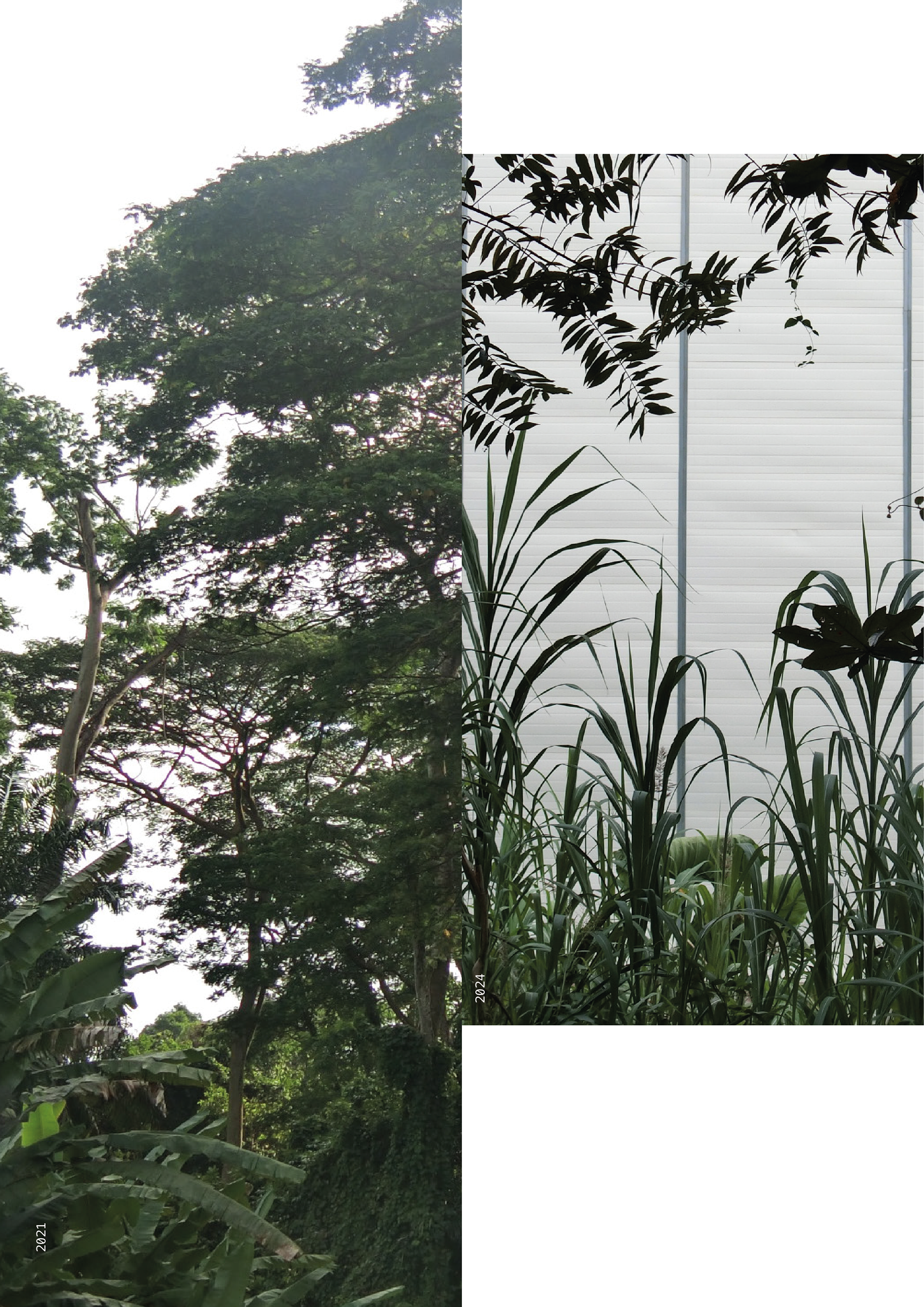
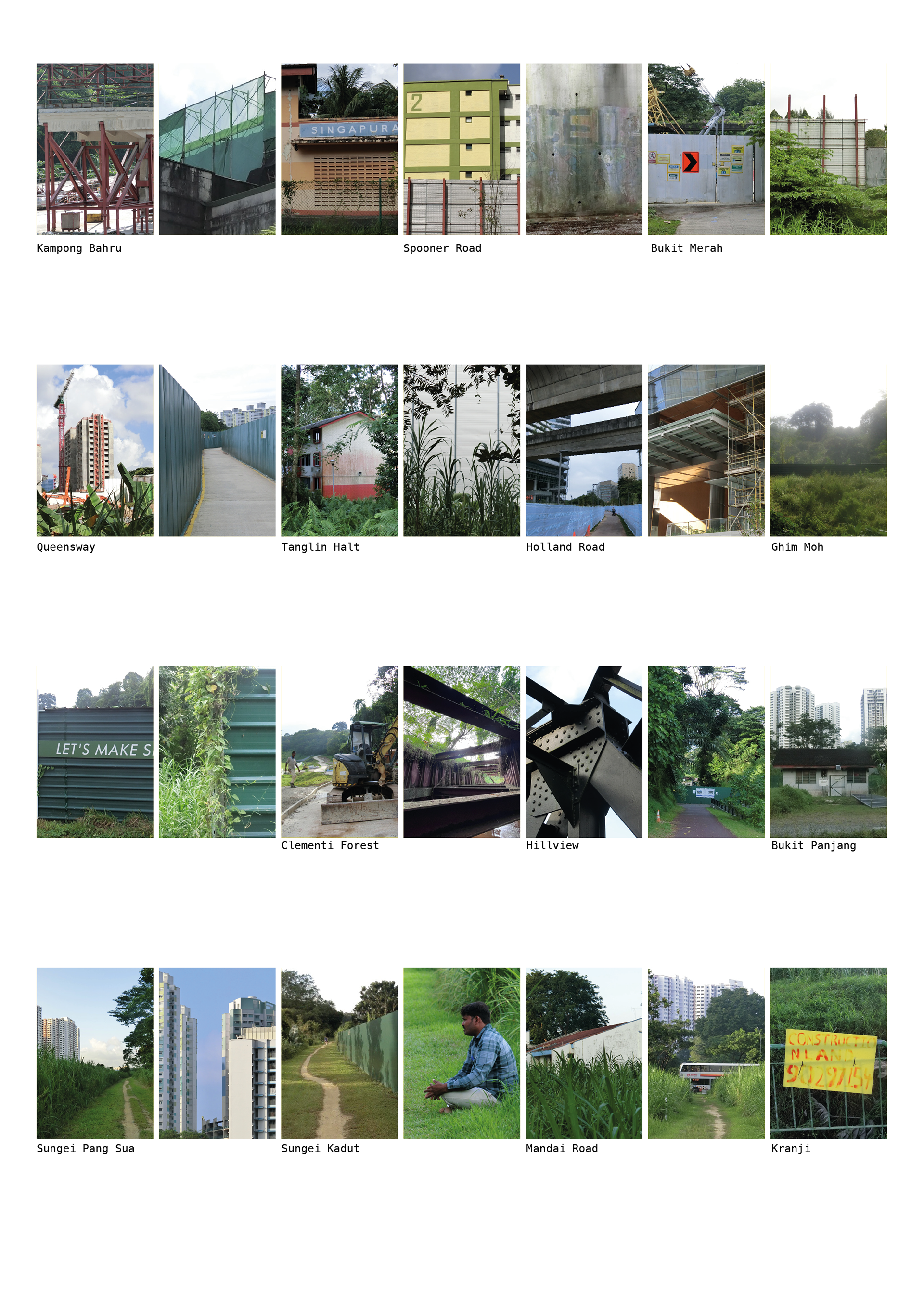
This project explores how land along the rail corridor in Singapore has been used and developed since it was handed over. I’m particularly interested in the areas designated as green spaces on the URA Map managed by NParks. By using a mix of research methods, I’m looking into how these green spaces have changed between 2021 and 2024. We’re comparing this with official urban planning maps as well as satellite images and photos I’ve collected. The goal is to understand how green areas are perceived in Singapore and how quickly things are changing along the rail corridor. Most importantly, we want to ask: who benefits from these changes?
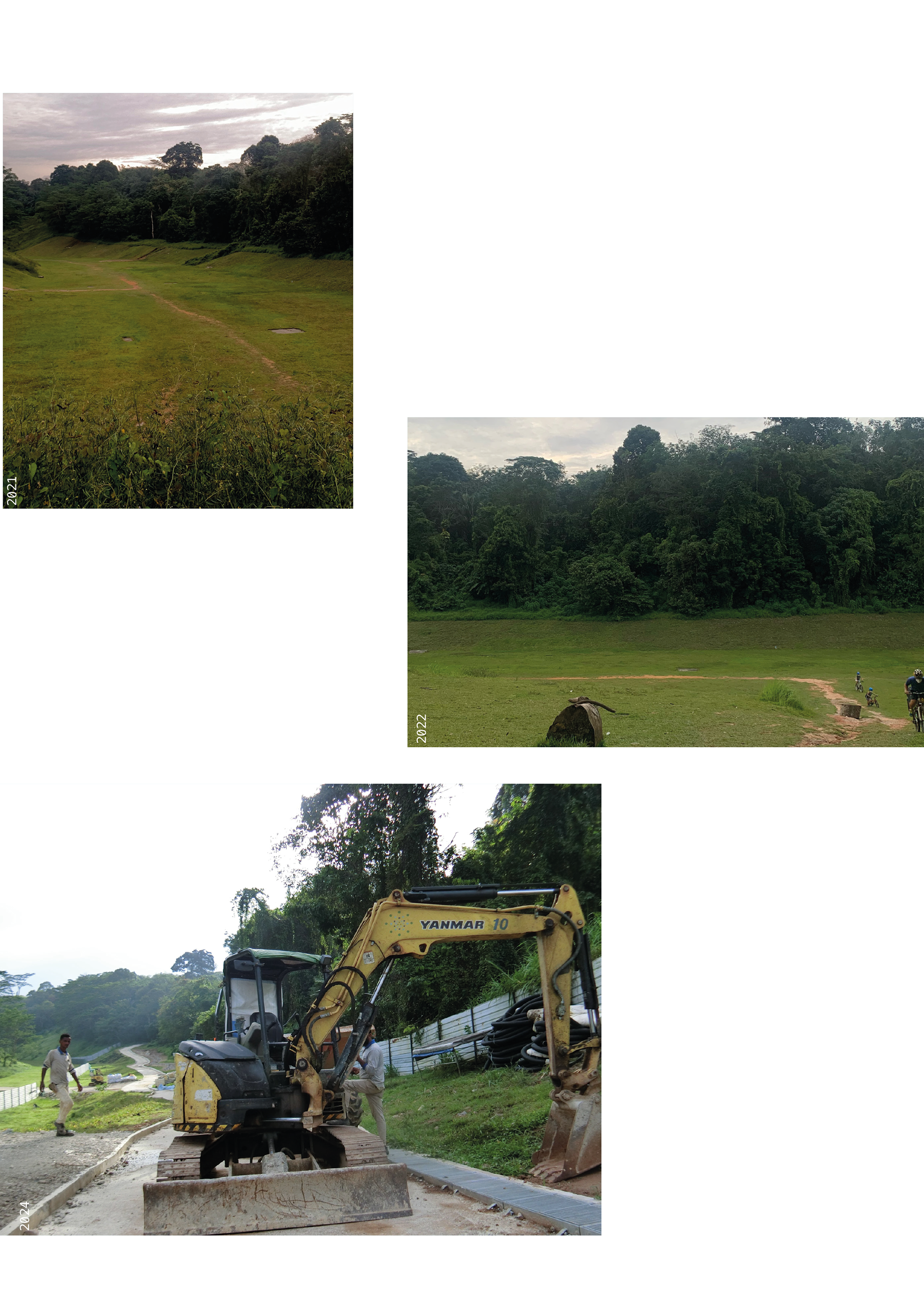
The Clementi Forest, nestled between Bukit Timah and Clementi, has long been cherished for its lush greenery, abundant wildlife, and tranquil streams meandering beneath the railway tracks. But over just three short years, the once pristine landscape has been dramatically altered by redevelopment efforts.
Along the MRT viaduct and spanning through Buona Vista, numerous buildings now stand atop what used to be lush greenery, formerly belonging to the Malaysian Railway network. In just three years, tall concrete structures have sprung up on either side of the rail corridor, transforming it into a developed mixed-use development zone.


As I journey past the AYE viaduct and approach Queensway, I notice a significant transformation. Once a sprawling forested area surrounded with colonial bungalows, it’s now a scene of boarded-up construction site and concrete pathways. Towering construction cranes dominate the skyline, overshadowing the once majestic heritage trees.
Why is it all construction? Where are the tall trees? Who are we building for?
What is absent in many people’s eyes reveals a lot to me, This project is based from my personal observations along the rail corridor where nature flourishes. Given the scarcity of land, redevelopment is inevitable. The rapid transformation of our city often leaves me wondering: How can we preserve green spaces, and who ultimately benefits from the land?